
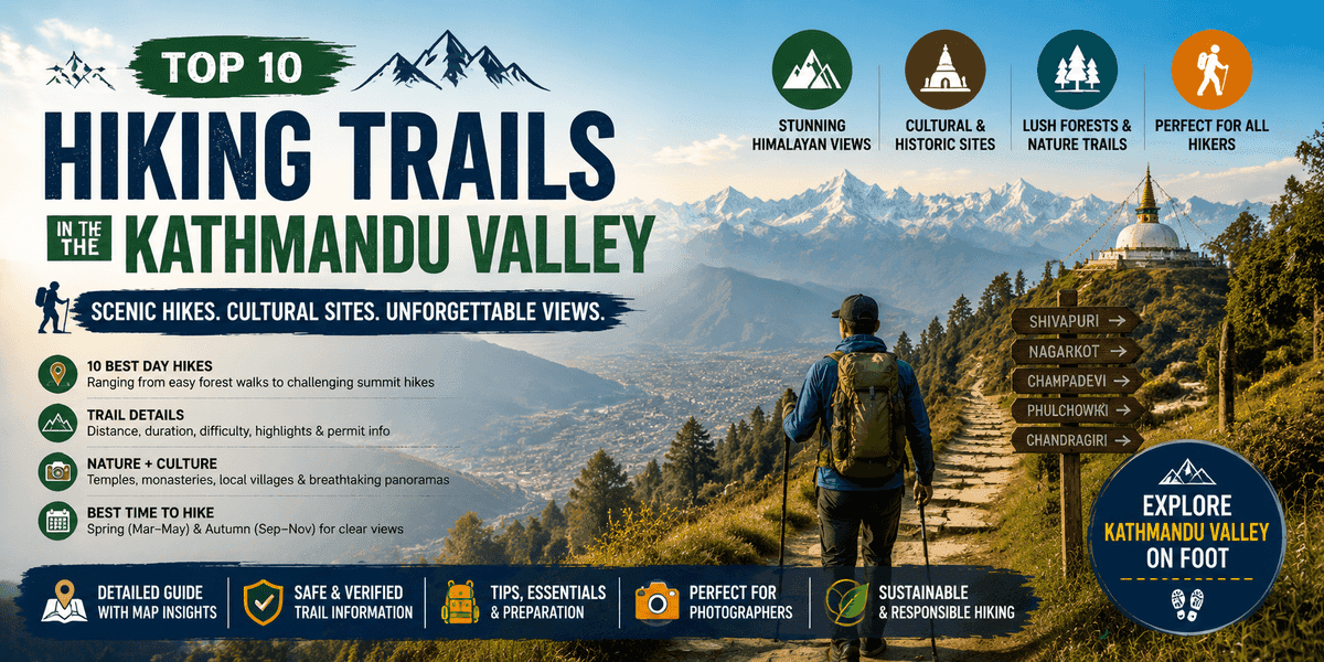
Top 10 Hiking Trails in the Kathmandu Valley
Kathmandu Valley is ringed by forested hills and historic monasteries, making it a hiker’s paradise. From the sacred springs of Shivapuri to the century-old Stupa at Namo Buddha, each trail offers its own mix of nature and culture. Below are ten day-hikes (3–7 h each) that showcase the valley’s best scenery. Each entry lists key facts – distance, difficulty, highlights – with recent source details for trail and permit info. (Most high-elevation routes are best in spring or autumn for clear weather.)
Discover the top 10 hiking trails in Kathmandu Valley, featuring the best day hikes near Kathmandu with stunning Himalayan views, peaceful forests, and cultural landmarks perfect for beginners and experienced hikers.
1. Shivapuri National Park (Budhanilkantha → Kapan)
Located on Kathmandu’s northern rim, Shivapuri Peak (2,732 m) is the source of the Bagmati River and the second-highest point in the valley. A typical loop hike begins at the Budhanilkantha Temple (the huge reclining Vishnu, ~1,350 m), then climbs past the Nagi Gompa nun’s monastery to Shivapuri’s summit, descending on trails toward Kapan Monastery. (Budhanilkantha is reachable by bus or taxi from Thamel, and the route is in Shivapuri-Nagarjun NP.) The trail is about 7–8 km round-trip and takes ~3–4 hours, with moderately steep sections. Note that park entry permits are required (e.g. ~NPR1,000 for foreigners).
- Highlights: Towering pine–oak forests, the Budhanilkantha Vishnu shrine and the Nagi Gompa nunnery with panoramic valley views. At the top, Himalayan ranges from Ganesh to Annapurna loom on the horizon.
- Difficulty: Moderate (steady climb, mostly well-marked).
- Approx. Distance: ~7–8 km round trip, ~3–4 hours.
- Permits: Required (Shivapuri–Nagarjun NP entry; ~NPR1,000 foreign fee).
- Tips: Start early for cooler temperatures and to avoid crowds. Spring blooms and autumn clear skies give the best views.
2. Nagarkot – Changunarayan Sunrise Hike
Telkot (Nagarkot) sits at ~2,190 m on the valley’s eastern edge, famous for Himalayan sunrises. Hikers typically get a pre-dawn drive up to Nagarkot tower and then proceed via Telkot toward Changunarayan Temple. From Telkot the trail drops gently through terraced villages and forests to the 5th-century Changunarayan Vishnu temple (alt ~1,500 m). The round-trip hike (Nagarkot→Telkot→Changunarayan→Telkot) is about 7–8 km and takes ~2–3 hours on foot, making it one of the most beginner-friendly routes.
- Highlights: Spectacular 360° sunrise over the Himalaya (Langtang, Annapurna and even Everest on a clear day); shaded village trails. At Changunarayan (a UNESCO World Heritage site) one can explore ancient Vishnu carvings on the hilltop temple.
- Difficulty: Easy (gentle descent, mostly stone steps and dirt paths).
- Approx. Distance: ~7–8 km, ~2–3 hours (excluding Nagarkot visit).
- Permits: None (Changunarayan Temple may have a small donation box).
- Tips: Combine with breakfast in Nagarkot. After sunrise, drive down to Telkot (~5–8 min) and start hiking. Locals recommend carrying water and a light jacket for early-morning chill.
3. Champadevi Hill (Hattiban → Machchhegaun)
South of Kathmandu, Champadevi is a dense-forest hill (2,285 m) overlooking Patan. The hike begins at Hattiban (Lalitpur) and ascends through rhododendron–pine woodland to the sacred Champadevi shrine on the summit. It’s about 4–5 hours round-trip (some take 3–4 h), with ~1,000 m of elevation gain. Champadevi is the valley’s third-highest peak, so clear days offer vast panoramas.
- Highlights: Forested trails with wild birds and orchids. At the top (a small hilltop temple), you see Himalayan giants: Gaurishankar, Langtang, Ganesh, Manaslu and Annapurna ranges. A Buddhist monastery on the return path adds cultural interest.
- Difficulty: Moderate (steady uphill; some roots/stones).
- Approx. Distance: ~8–10 km round-trip, ~4–5 hours.
- Permits: None required.
- Tips: Late afternoon climbs yield spectacular sunsets over Kathmandu. It’s possible to extend via Taudaha or Chobhar on the way back for longer day-hikes.
4. Phulchowki Hill (Godawari → Phulchowki)
To the southeast, Phulchowki is the highest hill in the valley (~2,782 m). One common route starts at the Godawari Botanic Garden (1,375 m) and winds upward through rich subtropical forest. The round-trip to Phulchowki summit takes ~4–5 hours and climbs about 1,400 m. This is a wildlife-rich hike: the botanical gardens and Shivapuri–Nagarjun NP protect many bird and orchid species.
- Highlights: Godawari botanical garden (national pinetum) at the base. Lush oak/rhododendron forest on the trail. The summit meadow offers 360° Himalayan views – Annapurna Massif to the west, Gaurishankar to the east.
- Difficulty: Moderate to strenuous (long continuous ascent).
- Approx. Distance: ~10 km round-trip, 4–5 hours.
- Permits: Required (Shivapuri–Nagarjun NP).
- Tips: The trail can be muddy in monsoon; dry-season or early spring bloom (April/May) is best. Carry plenty of water and snacks (little available on-trail).
5. Chandragiri Hill (Mata Tirtha → Chandragiri)
West of town lies Chandragiri (2,551 m), famous locally for its cable car and Shiva temple (Baleshwor Mahadev) at the top. The hike starts from the Mata Tirtha (Kathmandu) area (~1,400 m) and climbs through mixed forest. The summit, reached after ~3 hours of ascent, offers a 360° panorama of Kathmandu Valley and big peaks. (Many hikers then ride the cable car down, but one can also walk back.)
- Highlights: Quiet pine–oak forest trail. The summit temple and viewpoint restaurant (with Wi-Fi) overlook Kathmandu, the Annapurna/Langtang ranges and Kathmandu’s sprawl. Spectacular views of Mount Dhaulagiri and Langtang canes be seen on clear days.
- Difficulty: Moderate (steady 1,150 m gain).
- Approx. Distance: ~6–7 km one-way, ~3 h up.
- Permits: None (no national park).
- Tips: Combine with the cable car for a quick descent (tickets available at top). Leave after breakfast to avoid afternoon clouds.
6. Jamacho Peak (Nagarjun / Jamacho Hill)
Also inside Shivapuri–Nagarjun NP, the Jamacho (or Nagarjun) hike is less frequented than Shivapuri but equally rewarding. The peak (~2,128 m) is named Jamacho in local Tamang language. The typical trail (starting near Balaju) follows forest paths and visits a small Jamacho gompa on the summit ridge. It takes about 6–7 hours round trip.
- Highlights: Tranquil forest habitat (birdwatching, monkeys) and a Buddhist stupa shrine on top. A watchtower gives panoramic valley views. On a clear day one sees the Annapurna–Langtang ranges unfolding before you.
- Difficulty: Easy-to-moderate (mostly gentle slopes).
- Approx. Distance: ~10–12 km round-trip, 6–7 hours.
- Permits: Required (Shivapuri–Nagarjun NP entry).
- Tips: Pack lunch and water (no teahouses on-trail). Start early to enjoy morning light on the mountains, and remember to close any fire/litter before leaving the protected area.
7. Sundarijal – Chisapani Loop
From Sundarijal (northeast Kathmandu) one can do an out-and-back hike to Chisapani (2,100 m) within Shivapuri–Nagarjun NP. This is one of the most popular short treks near Kathmandu. The trail (≈15–18 km round trip) ascends through terraced fields to the village of Mulkharka, then climbs through rhododendron forests. Total hiking time is ~5–7 hours.
- Highlights: Sparkling Sundarijal Waterfall and dam just off the trailhead. Dense oak–rhododendron forest with bamboo groves. Panoramic views from Chisapani: on sunrise/sunset it lights up Langtang, Ganesh and Gaurishankar peaks. (Local guesthouses serve tea/snacks at Chisapani village.)
- Difficulty: Easy (gradual inclines on well-trodden stone paths).
- Approx. Distance: 15–18 km round-trip, 5–7 hours.
- Permits: Required (Shivapuri–Nagarjun NP).
- Tips: Take a local bus to Sundarijal early (1 h from Ratnapark). The route is also part of a longer trek to Nagarkot (2-day option). Check weather: morning fog can linger in monsoon season.
8. Amitabha (White Gumba) Monastery Hike
Just north of the Swayambhunath ("Monkey Temple") area, the Druk Amitabha Monastery (Seto Gumba) makes for a perfect short hike (half-day). You start near Swayambhu and hike through pine forests on a gentle road, looping about 12–15 km round trip. The summit monastery (~1,500 m) has snow-white walls and Tibetan murals.
- Highlights: The White Monastery itself (meditate among prayer halls and murals). From the hilltop café there are sweeping 360° views of Kathmandu Valley. On clear days nearby peaks (Ganesh, Langtang, Manaslu, etc.) punctuate the skyline.
- Difficulty: Easy (path mostly gentle; suitable for beginners).
- Approx. Distance: ~12–15 km round-trip, ~4 hours.
- Permits: None (outside national park).
- Tips: This route is popular at dawn/dusk since it rivals Nagarkot for sunrise views. Respect monastery etiquette (quiet and remove shoes if inside). There are no food stalls on the way up – pack water and snacks.
9. Kakani Hill (Balaju Loop)
Kakani lies above the western valley rim at ~2,030 m. A common day hike loops out of Balaju (Kathmandu) up through the Shivapuri reserve forest to the Kakani ridge. The 5–6 h route (up to 2,146 m) traverses pine woodlands. The summit area offers one of the most picturesque valley overlooks in the Kathmandu area.
- Highlights: Wide viewpoint tower overlooking Kathmandu. On a clear day the Annapurna range, Langtang and even Shishapangma are visible. Fairly open terrain and wildflower meadows (during spring rhododendrons).
- Difficulty: Easy–moderate (forest trail with gentle ups and downs).
- Approx. Distance: ~10–12 km round-trip, ~5–6 hours.
- Permits: None (though trail enters Shivapuri NP, local enforcement varies; best to carry park permit).
- Tips: There is a proper road tower at Kakani (often a gathering spot). In winter mornings the valley is often in fog, so aim for midday when clouds lift.
10. Dhulikhel – Namo Buddha Pilgrimage Hike
This cultural trail runs between Dhulikhel town and the Namo Buddha Stupa (Kavre Bhanjyang), a revered Buddhist site (~1,500 m). It’s an easy paved road walk with hill farm scenery. Hikers typically take 2–3 hours one-way from Dhulikhel to Namobuddha (total ~5–6 h). Namo Buddha is famous for the legend of a Bodhisattva and for its golden-topped stupa.
- Highlights: The Great Stupa (Amitabha) at Namo Buddha and its peaceful monastery complex. The summit viewpoint (behind the stupa) offers 360° views of the valley below. Rural villages and terraced fields en route give a sense of local Newari/Tamang life.
- Difficulty: Easy (gradual road; accessible by all fitness levels).
- Approx. Distance: ~12 km one-way, 2.5–3 h walk.
- Permits: None (no NP involved).
- Tips: A small donation to the monastery is customary (often passed to monks). The best views come on clear days. Local buses run from Kathmandu to Dhulikhel if you wish to hike one-way.
Tips for All Hikes
- Best Seasons: Spring (March–May) and autumn (Sept–Nov) for clear skies and floral blooms. Monsoon summers have heavy rain on trails; winter can be cold (especially at higher elevations).
- Preparation: All trails are on public land, but bring water (streams may be dry late season), sun protection and sturdy shoes. Many hilltops are sunny and exposed.
- Safety: Trails listed here are generally safe; avoid after dark. In Shivapuri–Nagarjun NP (Shivapuri, Chisapani, Jamacho, Kakani, Phulchowki) carry a park permit (checked at entry gate). Mobile signal is spotty in forests – have an offline map or guide if venturing into thicker jungle.
- Transport: Kathmandu city buses or microbuses run to most trailheads (Sundarijal, Telkot/Nagarkot, Dhulikhel) for a few hundred rupees. Taxis/tuktuks can also reach many start points. Some trails (Champadevi from Hattiban, Kakani from Balaju) may require arranging a drop-off.
- Etiquette: Keep the hills clean. At monasteries and temples, be respectful (remove hats, maintain silence). Altitude is not extreme, but always hike at a comfortable pace and stay hydrated.
Each of these day hikes can be done independently or as part of a guided tour. They offer a refreshing escape from city crowds and a closer look at Nepal’s natural beauty and cultural heritage. Hikers should always check the latest trail conditions and weather before setting out.
Kathmandu Valley’s Top 10 Hiking Spots (2026 Update)
Executive Summary: Kathmandu Valley offers an astonishing variety of day hikes that suit all fitness levels and interests. From tranquil forest trails to sacred monasteries and dramatic Himalayan viewpoints, these 10 selected hikes showcase the valley’s cultural highlights and natural beauty. Each route is described below with practical details – distance, elevation gain, duration, difficulty, best seasons, permits, transport, and facilities – to help you plan. (Local sources and trek guides were used for accuracy.) In general, the valley’s spring (March–May) and autumn (Sep–Nov) provide the clearest views and safest conditions. All but a couple of the listed hikes lie within Shivapuri–Nagarjun National Park or Nagarjun Forest Reserve, so visitors should anticipate park entry fees (roughly NPR 1000 for foreigners) and carry identification at the checkposts. Emergency services in Kathmandu are reached by dialing 100 (police), 101 (fire), or 102 (ambulance). The quick-tips and summary table below help compare and choose the right hike for your group (e.g. a gentle 1-day stroll vs a strenuous summit trek, or a romantic route).
| Rank | Hike | Location | Distance | Elev. Gain | Highest Elev. | Duration | Difficulty | Best Season | Permit | Notes (Highlights) |
|---|---|---|---|---|---|---|---|---|---|---|
| 1 | Shivapuri | Budhanilkantha (Kathmandu) – Shivapuri Peak | ~18–20 km (loop) | ~1,800 m | 2,732 m | ~6–12 hours | Moderate–Strenuous | Mar–May, Sep–Nov | Yes (NPR ~1000) | Nagi Gompa monastery, Bagmati river source, panoramic Langtang & valley views. Loop hike up south side, down north. |
| 2 | Nagarkot–Changu Narayan | Nagarkot (Bhaktapur) to Changunarayan Temple | ~15.6 km (one-way) | –634 m (net drop) | 2,175→1,541 m | ~3–4 hours | Easy–Moderate | Oct–Apr | Temple fee NPR 300 | Morning sunrise in Nagarkot; downhill through Tamang villages and forest; ancient Changunarayan Temple (UNESCO) at end. |
| 3 | Champadevi | Pharping (SW Kathmandu) | ~12–14 km (round) | ~800–900 m | 2,285 m | ~4–6 hours | Moderate | Mar–May, Sep–Nov | No | Short steep ascent to a hilltop temple; sweeping Kathmandu Valley views at sunset. Two main routes (via Pharping or Machhegaun) of similar length. |
| 4 | Phulchowki (Godawari) | Godawari (SE Kathmandu) | ~~26 km (loop)~~ or ~12–14 km (one-way) | ~1,200–1,600 m | 2,782 m | ~6–8 hours | Strenuous | Mar–May, Sep–Nov | Yes (Shivapuri NP) | Highest hill in valley; virgin forests and birdlife; army checkpost at top and small Hindu temple. Long ascent (up to ~26 km round trip) and hard climb. |
| 5 | Chandragiri | Thankot (SW Kathmandu) | ~4 km (one-way) | ~570 m | 2,551 m | ~2–3 hours | Moderate | Mar–May, Sep–Nov | No | Bhaleshwor Mahadev temple at summit; panoramic Kathmandu and high Himalayan views. Cable car available (for descent) to shorten return. |
| 6 | Jamacho (Nagarjun) | Phulbari Gate (NW Kathmandu) | ~8–9 km (round) | ~600 m | 2,164 m | ~5–7 hours | Easy–Moderate | Mar–May, Sep–Nov | Yes (Nagarjun Forest) | Buddhist monastery (Jamacho Gompa) near the top; valley vista from Jamacho peak. Gentle climb through park forest. |
| 7 | Sundarijal–Chisapani | Sundarijal (NE Kathmandu) | ~12 km | ~+770 m | 2,425 m (Borlang) | ~4–5 hours | Moderate | Mar–May, Sep–Nov | Yes (Shivapuri NP) | Starts at Sundarijal dam temple, then steep stone steps through forest. Ends at Chisapani (views, teahouses). Option to continue on to Nagarkot. Park permit needed. |
| 8 | Amitabha Monastery (White Gumba) | Near Swayambhu (SW Kathmandu) | ~5–6 km (one-way) | ~100–150 m | ~1,500 m | ~2–4 hours | Easy | Mar–Nov | No | Gentle hike to a colourful Tibetan monastery set on a hill (1500m); overlooks Kathmandu. Shortest, most accessible route (no parks). Often visited for sunrise or a short scenic outing. |
| 9 | Kakani–Suryachaur | Kakani (NW Kathmandu) | ~10–12 km (one-way) | ~0–100 m | ~2,070 m | ~3–4 hours | Easy–Moderate | Mar–May, Sep–Nov | Yes (Shivapuri NP) | Ridge walk through rhododendron forest and Tamang villages. Stellar panoramas of Langtang, Manaslu, Ganesh Himal. Thai Memorial park and strawberry farms en route. |
| 10 | Namobuddha – Dhulikhel | Dhulikhel (Kavre) – Namo Buddha Monastery | ~10 km (one-way) | +200 m | 1,750 m | ~4 hours | Easy–Moderate | All year (dry) | No | Cultural hike to a sacred Buddhist monastery (Namo Buddha) on a ridgeline. Gentle terraced village trail with mountain views (views of Ganesh, Gaurishankar, Langtang). |
1. Shivapuri Peak (Budhanilkantha → Shivapuri)
Shivapuri Nagarjun National Park lies immediately north of Kathmandu. The classic loop hike starts in Budhanilkantha (reclining Vishnu temple) and climbs 1,800+ meters to Shivapuri Peak (2,732m). Total distance is roughly 18–20 km (circuit), taking 6–12 hours depending on pace. A national park permit is required (about NPR1000 for foreigners, NPR600 SAARC, NPR100 Nepalis). The trail first passes the Nagi Gompa monastery, then reaches Bagdwar (source of the Bagmati River) before the final ridge ascent. On a clear day you get sweeping views over the Kathmandu Valley and the peaks of Ganesh/Langtang ranges. There is a tea stall at Nagi Gompa (~2–3 hr in), but no full lodges – this is typically done as a day hike. (Some hikers split it overnight, camping near the summit, but not common.) Steep sections and altitude gain make it moderate to strenuous, so ensure water, snacks, sun protection and start early. Best seasons are spring and autumn.
2. Nagarkot – Changu Narayan
Nagarkot (2,175 m) is famed for its Himalayan sunrise views. This hike begins at Nagarkot View Tower and descends about 634m over ~15.6 km through villages to Changunarayan temple (1,541 m). It is mostly downhill, making it an easy-to-moderate walk, typically 3–4 hours of hiking time. There is no park permit needed (the trail is public), but the Changunarayan temple charges a small entry fee (~NPR300). Starting extremely early to catch sunrise in Nagarkot is popular; you can either stay overnight in Nagarkot or drive up early. The route winds past tea houses and terraces (Telkot village area) before entering forest. Highlights include morning light on Annapurna–Manaslu–Langtang peaks and the 4th-century Changu Narayan temple (UNESCO site). Return transport from Changunarayan is by jeep or bus via Bhaktapur. Dry winter and spring months are best (the route gets muddy in monsoon).
3. Champadevi Hill
Champadevi (2,285 m) is a sacred shrine west of Kathmandu. The easiest route starts from Pharping (Takshi Hill area) or nearby Hattiban, totaling about 12–14 km round trip. Elevation gain is ~800–900m; allow ~4–6 hours. The trail winds through pine and rhododendron forest to a hilltop temple. There are no steep staircases, but the final sections can be rocky. The summit offers 360° views of the valley and distant Himalaya (Langtang range in the north). A rustic tea house operates at the top temple. No permit is needed (the hill is outside park boundaries). Good seasons are spring and autumn. (An alternate longer route continues via Machhegaon and Kirtipur, but most visitors take a simple out-and-back to Champadevi and return the same way.)
4. Phulchowki (Godawari)
Phulchowki (2,782 m) is the highest hill in Kathmandu valley, located near Godawari Botanical Garden in the southeast. The standard hike starts at Godawari (about 1,500 m) and climbs ~1,280 m, returning by the same trail (or a loop via Dhobidhara and Niroula) for up to ~26 km total. A round-trip usually takes 8–10 hours of very steep climbing – this is one of the toughest valley hikes. Because the trail lies in Shivapuri-Nagarjun NP, an entry permit (NPR1000) is required at Sundarijal or Godawari checkpoint. The forest is thick and rich in bird life (Phulchowki is famous for Himalayan birds). At the summit sits a small temple (Phulchowki Mai) with panoramas of Ganesh, Langtang and Gaurishankar. Water sources are scarce after Godawari, so carry plenty. Best done in dry spring/autumn; monsoon (Jun–Aug) brings leeches and slippery trails.
5. Chandragiri Hill
Chandragiri (2,551 m) is a popular hill southwest of Kathmandu (Thankot area). One can hike ~4 km from Thankot (2,000 → 2,551 m, ~550m gain) in about 2–3 hours. The trail through oak and pine forest is moderately steep but well-trafficked. Alternatively, many people take the cable car to the top and hike down. At the summit stands the historic Bhaleshwor Mahadev temple and a park with restaurants. On clear days there are sweeping views of Kathmandu Valley and snow peaks from Annapurna to Everest. No permit is needed. Facilities at the top are excellent (cafes, toilets, gift shop). For hikers, a typical plan is to hike up in the morning (or cable car up) and enjoy the views, then take the cable car back down (round-trip ticket ~NPR825 for foreigners). Best in autumn/spring; winters can be very foggy.
6. Jamacho (Nagarjun Hill)
Jamacho Peak (also called Jamachcho, 2,095 m, sometimes referred as part of Nagarjun Hill) is a gentle trek in the Nagarjun Forest Reserve (northwest Kathmandu). The usual trail starts at the Phulbari (Nagarkot) Gate of Shivapuri-Nagarjun NP and climbs about +600 m to the top. Round-trip is ~8–9 km, taking ~5 hours. The hike is rated easy to moderate, with wide trails and no particularly steep sections. The highlight is the Buddhist Jamacho (Seto Gumba) monastery a short distance below the summit, plus 360° valley views from Jamacho peak. A park permit (same Shivapuri fee) is required at Phulbari Gate. There are no shops or lodging on the trail, but a small café or homestay near Jamacho (managed by monks) serves refreshments. This hike is ideal for beginners or families. (It can also be done as part of the Chisopani/Nagarkot trek.)
7. Sundarijal – Chisapani
This classic Kathmandu-area trek begins at Sundarijal (water supply dam, ~1,350 m) and climbs through Shivapuri Park. The outbound hike (one-way) is about 12 km, gaining ~770m to Chisapani (~2,120 m) over 4–5 hours. Most hikers go one-way and return to Sundarijal (another 4-5 hours). The first section is a steep stone staircase (nearly 1,000 steps) up to a ridge (Borlang Bhanjyang, 2,425 m), then a gentler forest trail down to the hilltop settlement of Chisapani. Chisapani has lodges and shops, making an overnight possible. This route requires the Shivapuri Park entry permit at Sundarijal (NPR1000, obtained there). The views from Sundarijal are lush valley scenery, and from Chisapani you can see Ganesh/Langtang/Lirung, especially at sunset. It is moderate grade (stiff climb), best done in dry season. Many trekkers continue on from Chisapani to Nagarkot, but even Sundarijal–Chisapani alone is a rewarding day hike with waterfalls and forest.
8. Amitabha (White Gumba) Monastery
The Amitabha (Seto) Gumba hike is an easy, short outing near Swayambhunath. Starting from the base of Swayambhu (or from Ichangu Narayan), it follows village roads and a short trail up to the white Tibetan monastery at ~1,500 m. Round-trip is only ~4–6 km, taking 2–3 hours for a gentle loop. (Some guided tours include a brief drive to the trailhead.) There is virtually no altitude gain (Swayambhu ~1,350m to monastery ~1,500m), making this suitable for beginners or families. No permit is required. The monastery itself occasionally closes (check ahead); if open, you may explore the courtyard or meditate. From the hilltop there are nice views over the city and Swayambhu stupa. The surrounding Shiva forest is pleasant for a picnic. This makes an ideal half-day excursion. A small tea shop operates near the monastery. Because the trail is short, one often combines it with the nearby Swayambhu Monkey Temple or Ramkot for a longer outing.
9. Kakani – Suryachaur
Kakani (2,070 m) is a hill station northwest of Kathmandu (about 25 km from the city). From the Kakani Scout Camp (Thai Memorial Park) one can hike 10–12 km one-way along a forest ridgeline to Suryachaur (the paragliding field, ~1,925 m). Net elevation change is minimal (ridges), making it easy to moderate. Hiking time is roughly 3–4 hours. The trail (which enters Shivapuri-Nagarjun NP) winds through pine and rhododendron forest, passing Tamang villages and strawberry farms. Panoramas of Langtang, Ganesh, Manaslu and even Annapurna appear through clearings. Park entry permit is required (Shivapuri NP fee). At Suryachaur there is a small teahouse and a viewpoint. One can either return the same way or descend by vehicle from Suryachaur to Kathmandu. This family-friendly hike is best in spring when rhododendrons bloom or in autumn for crisp mountain views.
10. Namobuddha – Dhulikhel
The Dhulikhel–Namobuddha trail is an easy cultural hike east of Kathmandu. Starting in Dhulikhel (1,550 m), the path climbs through villages and terraced fields to Namo Buddha monastery (1,750 m). The distance is about 10 km one-way, taking roughly 4 hours at a relaxed pace. (Some routes continue from the monastery down to Panauti, making it a ~20 km loop.) The trail offers glimpses of Himalayan peaks (Langtang, Ganesh, Gaurishankar) on clear days. Namo Buddha is a revered Buddhist site with colorful stupas and temples – visitors often meditate or enjoy tea at the Guest House before returning. No park permits are needed. The hike’s gentle gradients and cultural sites make it suitable for all ages and seasons (avoid heavy monsoon rains). Many tours combine Dhulikhel town sights, the monastery, and Panauti village in one loop day-trip.
Quick Tips for Kathmandu Hikers
- Timing: Spring (Mar–May) and autumn (Sept–Nov) bring the best weather and clear skies. Monsoon season (Jun–Aug) often makes trails muddy or slippery (except for low-altitude walks like Amitabha Gumba, which still can be done if it’s not raining hard). Winter mornings can be cold and foggy, but often sunny by midday.
- Permits: Most trails above Kathmandu require the Shivapuri–Nagarjun NP or Nagarjun Forest entry permit (showing ID), currently ~NPR1000 for foreigners (NPR600 SAARC, NPR100 locals). Permits are sold at park gates (e.g. Sundarijal, Phulbari Gate, Kakani entry). Changunarayan Temple has its own small entry fee.
- Gear: Good hiking boots or sturdy shoes are recommended (stone steps and forest trails can be uneven). Carry 2–3 liters of water, sunscreen, a hat and snacks. Layers (windbreaker/polar fleece) are useful even day-hikes, since high points can be cool. Trekking poles help on steep climbs. Map apps or GPS can assist, though most trails are fairly well-marked; having an offline map is wise. Always pack any needed medication.
- Transport: Public buses or micro-vans connect Kathmandu with trailheads (e.g. Budhanilkantha, Sundarijal, Changunarayan, Kakani, Dhulikhel). Taxis or private jeeps (e.g. for Nagarkot or Dhulikhel) are faster but more costly. Plan return transport if needed (e.g. arrange for a jeep pickup from Changunarayan or Panauti).
- Facilities: Many trails have minimal services. Basic “tea-stalls” (Dhabas) exist at major waypoints (Nagi Gompa on Shivapuri, Chisapani lodges, Changunarayan temple area, Namo Buddha). Always carry extra snacks in case village shops are sparse. Toilets are rare except at major checkpoints or temples.
- Safety: Trails in the Kathmandu valley are generally safe. Watch for loose steps or roots, especially when wet. Leech socks or repellent can help in rainy forest sections (Sundarijal, Phulchowki). Beware monkeys near urban trailheads (Sundarijal, Swayambhu) – do not feed or provoke them. Always tell someone (hotel/guide) your plan if hiking solo.
- Enjoyment: Start early to avoid midday heat and maximize views. Dawn or dusk hikes (Nagarkot sunrise, Shivapuri sunset) can be spectacular but check return transport if needed. Respect local customs: buy permits at gates, dress modestly at religious sites, and keep noise down at monasteries. Leave no litter; many trails pass through sacred areas and community lands.
Emergency Contacts (Kathmandu): Police: 100; Fire: 101; Ambulance: 102. The Nepal Ambulance Service (hospital EMS) is reached at 102, and most Kathmandu hospitals have emergency departments (e.g. Bir Hospital, TU Teaching Hospital). Always carry basic first-aid (plasters, painkillers) and a charged phone.
Recommendations by Fitness Level:
- Beginner/Short Hikes: Amitabha (White Gumba) and Nagarkot–Changu Narayan offer easy terrain and cultural interest. These can be done in half to full day without much strain.
- Moderate Day Hikes: Shivapuri (long day), Champadevi, Kakani-Suryachaur, and Sundarijal–Chisapani are intermediate – moderate climbs and longer distances. Plan to spend 6–8 hours and bring lunch.
- Strenuous/Romantic: For maximum payoff, Shivapuri sunrise/sunset or Phulchowki at dawn are dramatic (strain = reward). Couples may enjoy the cable-car view at Chandragiri or a picnic on Kakani Ridge. Nagarkot at dawn followed by the gentle descent to Changu Narayan makes a memorable couple’s hike.
Sources: Distances, elevations and trail details are based on local trekking guides and park information, as well as Nepali tourism and hiking websites. (All route data and recommendations are current as of mid-2026.) Enjoy safe adventures in Kathmandu’s great outdoors!
⚠️ Disclaimer The information provided in this article is for general guidance and informational purposes only. Hiking distances, duration, difficulty levels, and trail conditions may vary depending on weather, season, and individual fitness levels. Readers are advised to check current local conditions, required permits, and safety guidelines before planning any hike.